Section E13 Minmi
This section applies to land identified within Map 1: Minmi.
This section applies to all land within the heavy line marked up on Map 1: Minmi.
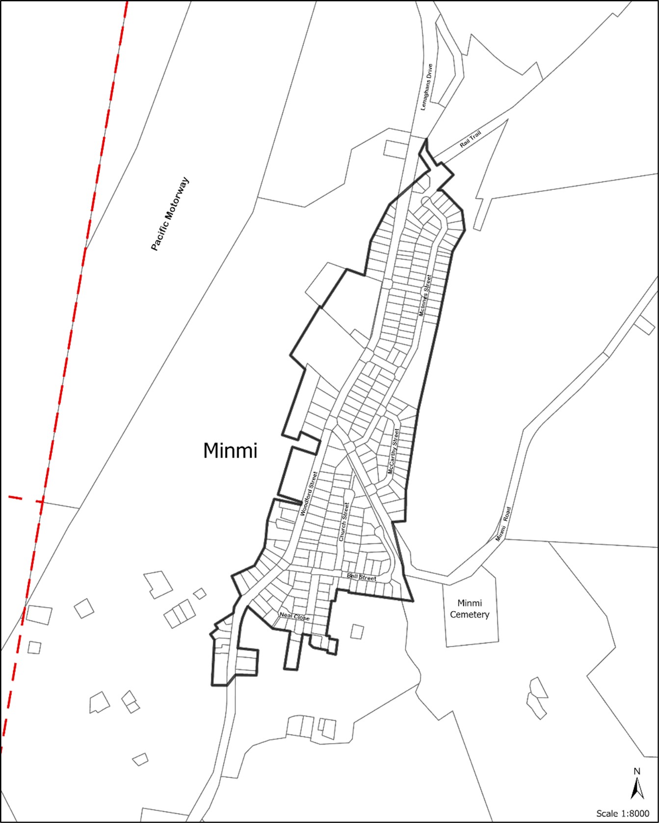 Map 1: Minmi
The following sections will also apply to development:
The following sections may also apply to development:
- B1(a) Flood management - pre 2019 flood studies
- B1(b) Flood management - post 2019 flood studies
- B2 Bush fire protection
- B3 Mine subsidence
- B4 Aboriginal cultural heritage
- B5 Historical archaeology
- B7 Land contamination
- C1 Traffic, parking and access
- C2 Movement networks
- C3 Vegetation preservation and care
- C4 Stormwater
- C5 Soil management
- C6 Waste management
- C7 Safety & security
- C8 Social impact
- C9 Advertising and signage
- C10 Street awnings and balconies
- C11 Development adjoining laneways
- C12 Open space and landscaping
- C13 Liveable housing
- D1 Subdivision and lot consolidation
- E1 Built and landscape heritage.
- Ensure that Minmi retains its existing village character.
- Develop as a westernmost local activity centre for the Western corridor.
- Ensure that the built heritage and character of Minmi is preserved.
- Contribute to tourist related development and strengthen the local employment base.
A word or expression has the same meaning as it has in Newcastle Local Environmental Plan 2012 (LEP 2012), unless otherwise defined.
Controls (C) |
C-1. Compatible uses of development are encouraged throughout the village, with more intensive uses located in the village centre. Art and craft related activities are encouraged. |
Controls (C) |
C-1. Open space is provided within the village and integrated with community uses. |
C-2. Landscape design reinforces the identity of Minmi as a distinct village area separated from other residential development, by establishing and reinforcing landscape features. |
Controls (C) |
C-1. Revegetation restores the diversity of indigenous species originally present, which may have been lost |
C-2. New development does not adversely affect (and preferably benefits) downstream Hexham Wetlands, which is recognised as being of international significance as habitat for migratory birds. |
Controls (C) |
C-1. In general, no building shall exceed two storeys in height, in keeping with the existing character of the area. |
C-2. Vistas to rolling hills and distant rural and natural landscapes are retained to maintain village context and identity. |
Controls (C) |
C-1. Where significant land disturbance is proposed, investigations of impacts on both Aboriginal and European heritage is required and field investigations or excavation may be necessary. |
The majority of the area drains into Minmi Creek, which subsequently flows into the Hexham Wetlands. Minmi Creek receives runoff from Minmi Village, land identified in Section E10 (Minmi Extension, Village Centre and Link Road North Precinct) and E11 (Minmi East Precinct).
Controls (C) |
C-1. Drainage channels are retained in a natural condition or improved by rehabilitation. |
C-2. Vegetation corridors are maintained or regenerated along creeks. |
C-3. Discharges are managed to ensure no excessive export of sediments. |
C-4. Nutrients or stormwater flow rates are managed to ensure the health of nearby waterways and wetlands. |
Controls (C) |
C-1. The principles of walkability, connectivity, permeability, legibility and safety applies to all subdivision and access system design. |
Controls (C) |
C-1. As the area develops, it may be necessary to introduce traffic control devices within the village to promote safety, restrict fast moving traffic and enhance village character. |
Controls (C) |
C-1. Feature planting, signage and controlled views create a sense of arrival, unique character and reinforces the distinctiveness of the village to other urban development and surrounding bushland. |
Controls (C) |
C-1. Views to identified heritage items are maintained where possible. Screen planting may be introduced to prevent inappropriate views to and from incompatible land uses, which may detract from the sense of place, or to control views to enhance heritage aspects. |
Controls (C) |
C-1. Measures are taken to assess the nature of any contamination or effect and take remedial action where necessary, having particular regard for past mining and filling activities. |